Left Column Top
Left Column Bottom
Right Column
Coast 4U Quarterly, Spring 2013
Upper Newport Bay The Upper Newport Bay watershed expanded from 15 square miles to 154 square miles after flood control
efforts in the 1970s channelized streams and rivers in this high population area. Broadening the watershed had
a huge impact on the Upper Newport Bay. The bay now accepted larger loads of sediment and trash which
altered the ecology of the marine and salt marsh habitats.
The Upper Newport Bay lies in central coastal Orange County, bounded to the south by the Newport Harbor and draining a mostly suburbanized 154 square miles in its watershed. While the historical human impacts on this natural area have been great, it remains one of the healthiest coastal bays in Southern California. With approximately 750 acres of salt marsh, the bay has never been blocked to the tides and therefore maintains a functioning salt marsh habitat as well as upland habitat that provide homes and resting places for 165 species of birds (many of them migratory), 80 species of fish, and 20 species of reptiles and amphibians. In addition, approximately 240 species of native plants have been observed in the protected lands of the Upper Newport Bay.
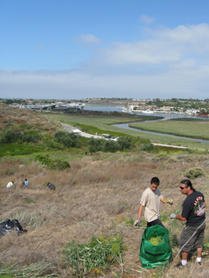
New visitors should be sure to visit the Muth Interpretive Center at the north end of the bay. The Interpretive Center offers exhibits about the bay's natural history and an interactive classroom for the bay's youngest visitors. The Muth Interpretive Center is also an ideal place to start your hike on the bluffs with overlooking vistas as well as pick up the paved bike path that nearly circumnavigates the bay. The Back Bay Science Center at the south end of the bay provides classroom space for older students and adult learners while providing easy access to the bay to study marine life. While the Science Center is only open during scheduled programs, visitors are welcome to attend an open house each Sunday from 10am-2pm. The Coastal Commission's Community-Based Restoration and Education Program (CBREP) operates out of the Back Bay  Science Center. CBREP has educated thousands of volunteers while successfully restoring over 14 acres of coastal
sage scrub, riparian, and salt marsh habitats. You can learn more about CBREP, including ongoing weekly and monthly
volunteer opportunities at www.restorehabitat.org.
In addition, the Upper Newport Bay hosts a large cleanup event on Coastal Cleanup Day, held each year on the third Saturday of September - this year it will be September 21st. We hope you'll join us at the Upper Newport Bay very soon. Experience the California Coast: Beaches and Parks in Southern California is an excellent guide for visiting this wonderful coastal area.
|


